
Southwest: In Counterclockwise Fashion
DAY 0
After a brief stop to get groceries, my drive West began at home base, Monument, Colorado. Getting through Loveland Pass was painless, things were slow approaching Eisenhower Tunnel, and Vail/Independence Pass looked beautiful in snow. I sure hoped my destination didn't have any snow, or remanence of it, as I'd need dry ground to drive on.

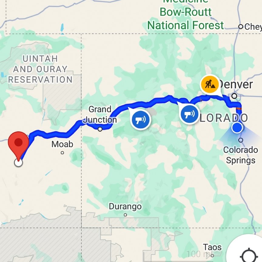
Map showing the overall route for the Southwest In Counterclockwise Fashion photography road-trip.
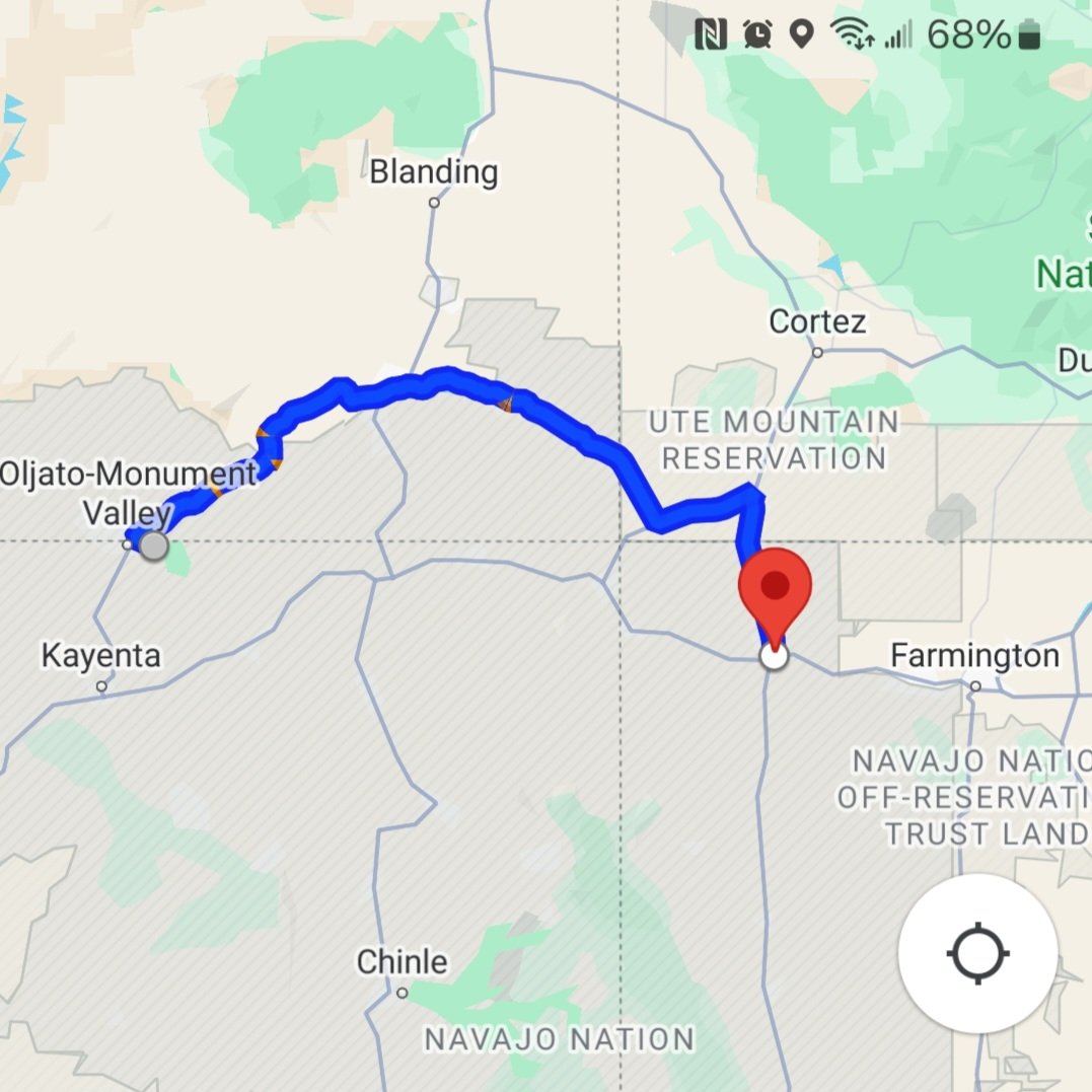
My “planned” route would take me from Monument, CO to (A) Hanksville, UT, then to (B) Escalante, UT, (C) Kanab, UT, (D) Page, AZ, (E) Monument Valley, AZ, (F) Shiprock, NM, (G) Bisti, NM, and finally back to Monument, CO. Today's drive would be the longest drive of the trip. I'm not a fan of spending my days driving. I'd rather spend them scouting or photographing an area. With that, I planned my stops accordingly.
Map showing leg #1 of the Southwest In Counterclockwise Fashion photography road-trip.
The map said it'd take 7.5 hours. I figured 8 hours with refueling. Before I knew it, I was turning into the seemingly lifeless area around Factory Butte.

I found the area around Factory Butte to be like a pot pie in places. The dirt was like a crust on top with it being wet underneath, at least in the places where I needed to go. #ElectricalGremlins
The range on my drone is short. Not because I can't get the drone to go out long due to rules/reception, but due to battery life. My batteries are old and discharge quickly. Not to mention that my drone is multiple generations old and technology has leaped it in many ways, one of them being battery life. Due to all of this, I’d have to snug myself up to Factory Butte the best that I could.
Driving around the hills surrounding Factory Butte was sketchy at best. At one point, I got too close to the edge and I slid sideways down a hill whether I wanted to or not. I knew there was a high probability that it would happen. I’m glad that I didn't hit a dry spot on the way down! Also, my drone was in the air recording during the incident, so there is likely footage, tho it probably felt more dramatic than it looked. There’s something about having or not having control of your vehicle can be like that, I suppose. I figured I'd chance it thinking 1) that I could get out of the situation, and 2) that there was no better time to try as there was a small group of 4x4 enthusiasts in the area. They’d likely be able to “rescue” me should I need it.
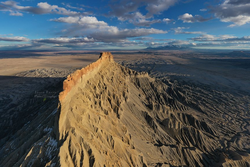
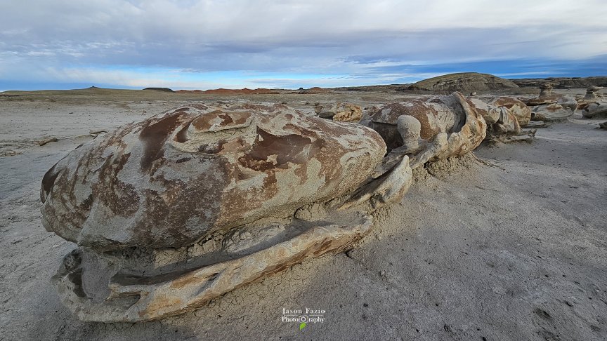
Factory Butte with the Henry Mountains int he background.
After what seemed like quite the adventure, I got myself into a position where I felt my drone's range was good. Wanting to take advantage of the cloud cover, I decided to launch a bit early as compared to Golden Hour and Sunset. I ran through my drone batteries in no time, shot what I could, and began making my way back toward the main road in the hopes that the 4x4 crew was still around just in case.
I managed to skirt around the area that gave me problems on the way in and made it out of the pot pie with ease. The next stop would be tomorrow morning's shooting location.
I rolled up to find the same 4x4 group already there. I jokingly asked them if they were following me. We all planned to shoot at the same location in the morning. It was going to be tough as there were five vehicles full of photographers already on location including me. We all likely wanted to shoot the same scene in the Blue Hour, Golden Hour, and Sunrise. It was likely going to be a test of patience and participation.
I let the Five Billion Star Hotel. (IG) run as I prepared dinner; a tuna pack and ramen, yum! I managed to get one drone battery fully charged and another partially. I'd try to top the other off in the morning during breakfast as I'm sure I'll crank up then too. I’m going to have to install a battery in the Delica for “house power.” I can’t keep leaving the Delica running to charge drone batteries. Add that to the List-O-Things-To-Do to the Five Billion Star Hotel. (IG)
DAY 1
Just as I suspected, plenty of people were looking to photograph/film the morning's sunrise from the cliff edges surrounding Factory Butte. We all staked our ground and waited for the sun. The problem is, nobody told the clouds as they didn't seem to be wanting to cooperate.

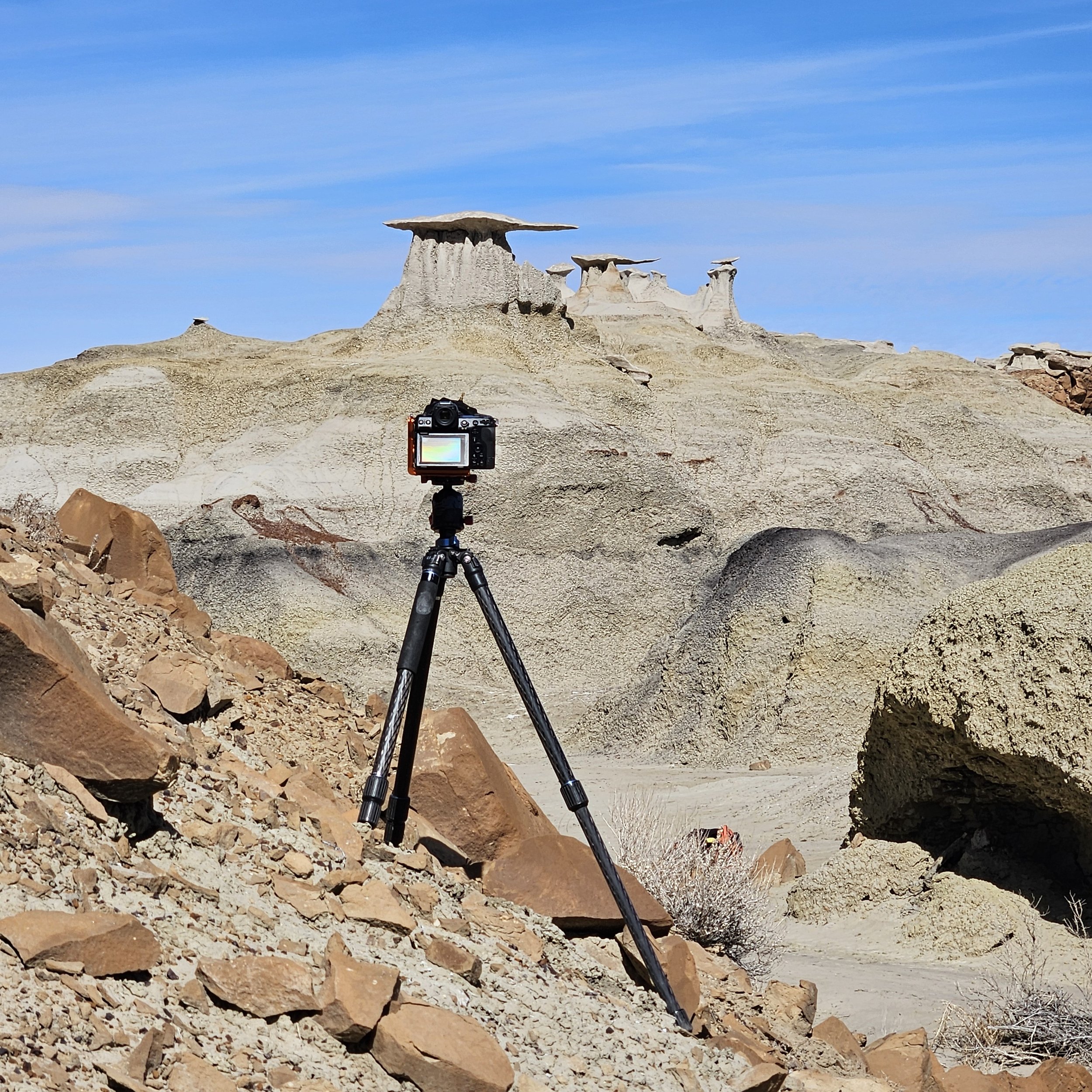
Behind-The-Scenes at the Moonscape Overlook, Utah.
I attempted a timelapse of the sunrise. Had a few equipment malfunctions along the way. Really, I got a new piece of equipment meant to hold my phone to my tripod leg. It slipped a few times, so the timelapse video will likely not be any good. That's okay. I learned a bit about the mount and its capabilities or lack thereof. After the morning's shoot, it was time to set my sights on my next destination, Escalante!

Pre Dawn at Moonscape Overlook, Utah
The morning flew by pretty quickly. Before I knew it, the sun was pretty high in the sky which was my cue to crank up and head out! My next destination was quite a few hours away. Not nearly as long of a drive as yesterday, but long enough nonetheless.

A Side-lit Sunrise
One last glance around before it was off toward Escalante!

While driving to my next destination, I ended up on what looked to be a very long dirt road into the Middle-Of-Nowhere, UT. I say that it looked like it because the road signs and my maps were conflicting as to how far I actually had to drive. To add insult to injury, my dash in the Five Billion Star Hotel (IG) is in KMs. So, I got out my handy dandy little calculator, punched in my current KMs, punched in the worst-case-scenario distance in Miles, and the calculator kicked out an answer too close for comfort. But, wait; it get worse!
I had been driving on this lonesome dirt road for quite some time before I saw the conflict with the distance to my next shooting locations. The only gas station was back the way I came. I’d have to backtrack, top off, and then return. The idea sounded terrible, but it sounded a lot better than being stranded.

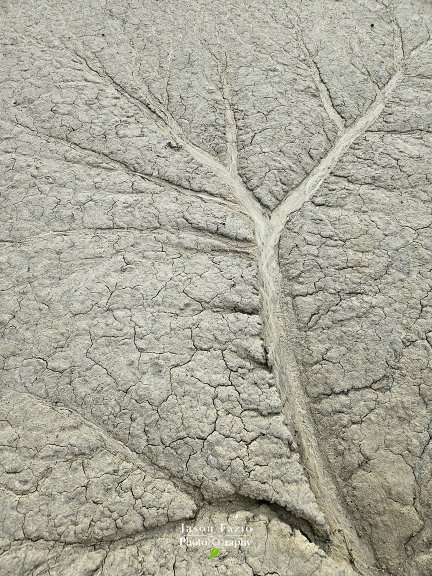
These “holes” are often ~25’ deep!
Finally, I got to the morning’s general area that I wanted to photograph. I had plenty of time before sunset, so I scouted the area out a bit. In a sea of obstacles, I managed to go right to the spot that I was looking for. Confident I’d be able to return to the location early in the morning, I left to find this evening’s sunset location that I wanted to photograph.
Driving around, I was pretty sure that I could see a distant arch from the road and was pretty sure it was the one I was looking for. The evening was fast approaching and my available time for scouting around was depleted. I picked out a distant object on the horizon that was in line with what I thought was my arch and began walking through the desert.
I was sure glad that I made note of the distant rock formation on the horizon as I lost sight of what I thought to be an arch many times during my desert stroll. This desert area, although it appeared flat before I began my trek, was anything but flat. Along my stroll, I saw what I thought to be cute little mouse holes here and there. After what seemed like forever, I was beginning to wonder if I really saw the arch in the first place. Regardless, I continued walking despite the ever-growing feeling that I should turn around. Eventually, I crossed a small wash. If I had to guess, thinking back, I’d say it was about 8" deep. I made note of it and pressed on up and over an oncoming upgrade. It was then that the arch appeared as I crested over the third ridge. I did see it from the road and my distant-horizon rock formation led me right to it! :-)

Behind The Scenes awaiting sunset.
As previously mentioned, I did not have a lot of time to scout around. I quickly set my camera up and hoped for the best as far as the cloud conditions went. To my right, in the image above, was a tall cliff surrounding the lower valley that I was hiking in. I suspected that the cliff would cast a large shadow that might engulf the arch before the sunset colors could materialize. This had me thinking of when a better time of year would be to return to this location. That’s one of the important things about preplanning your outings. If you don’t, you may end up photographing at a location where the lighting is less than optimal. This particular location was added to my agenda only hours before my arrival simply due to it being in proximity to where I wanted to be in the morning; a target of opportunity if you will. Looking over the scene, I do think I will return here in the future.
Before long, I was shooting the sunset. It was a fast one unlike some that I’ve seen that burn on and on. It seemed like I’d just arrived and already it was time to begin the hike back.

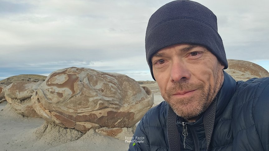
Me surveying the area prior to sunset
With the sun having set, I hiked back in the dark. I shot a reverse azimuth, aimed myself at a corresponding distant star on the horizon, and set off into the night. I only had about 20’ of visibility, so being surprised by walking upon things in the desert happened a lot. One of those things was those little holes that I’d seen earlier. They weren’t mouse holes at all. They belong to birds, tho I am not sure what kind. What I am sure of was that they jumped up and flew off right as I approached them. I was getting jump-scared about every 100’ that I walked.
Eventually, I hit that wash that I’d seen on the way in. This time, the wash was much deeper; 15' at least! I was definitely on a different path going back than I came in on. I wasn’t too concerned, it was a clear night; I still had my guiding star! Wouldn’t you know it, I walked straight to the Delica. Whew!
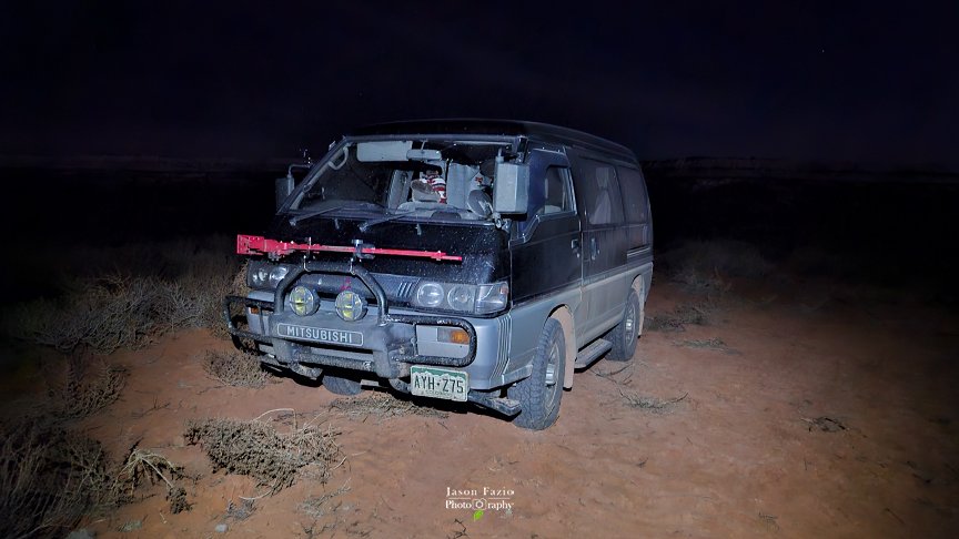
The Five Billion Star Hotel (IG), a Mitsubishi Delica L300
The hike took all that I had. I am not the hiker I used to be. I have the know-how, just not the ability and my energy levels and sore knees were a sharp reminder of that. Having made it back to the Five Billion Star Hotel (IG), it was time to grab a bite to eat and get some much-needed rest. The 0330 alarm would likely come early.
DAY2
As expected, the 0330 alarm came early and loud. Why so early you ask? It all had to do with the morning’s composition that I had planned. The morning's gear would be most of everything that I brought on the trip. I'd be shooting before sunrise and wanted to light up a few items. That meant I'd need my camera, lens, and tripod just to take pictures. I'd need my Low-Level Lighting (LLL) equipment. That consists of four lights and two tripods plus extra batteries for one of the pairs of lights. The other is rechargeable. This scene would also be unique in that I'd need a special piece of equipment. A piece of equipment that I bought specifically for this single composition.
I wanted to photograph a tree. The problem is, that that the tree resides deep in a hole. The sides of the hole are too steep to climb. As a matter of fact, if I were to fall into this hole, I'd likely be a goner. Not that it was so deep that the fall would kill me. More like I'd never be able to climb out and nobody would likely find me before the elements got me. Hence the need for the special piece of equipment.
I bought a small lamp that disperses light in all directions. In addition to that, it also puts out the color temperature that I wanted for this shoot; a nice warm light. I planned to attach the light to a length of paracord. I always have the cord with me in case I need to raise/lower my photography gear. I'd have to tie the other end of the rope to an extra tripod that I was bringing along and lower the light into the hole. Well, at least that's the plan.
What a difference daylight makes. Walking in this morning via headlamp made yesterday's scouting virtually worthless. I managed to find the tree that I marked in my mind as a waypoint, but 20' beyond that, I was clueless. I'd marked landmarks in my mind as waypoints to use to guide me into the morning's shooting location. The problem was, that I couldn't see the landmarks as they were often beyond the reach of my headlamp. Wandering around looking for a particular landmark, if you could recognize it via a headlamp light, was difficult as you could easily be barely going in the wrong direction and not even know it. I'd have to go off memory. Too bad I put so much emphasis on point-to-point navigation vs general direction. Oh, well; off I went into the darkness. To Add insult to injury, my right knee is beginning to hurt. I must've worn it out last night in the desert.
I did have a general idea of where my shooting location was on the map. The problem was, I had no service. My map was seemingly useless to me, even the local version that I’d downloaded as I couldn’t get it to route or show icons. Bummer.
I'd taken pictures of the area while scouting. They were useless as well as I couldn't see anything in the dark. Heck, I even knew the general coordinates of my shooting location; also useless. I'd have to wander aimlessly and hope for the best. There isn't a flat piece of ground in the place. Everything is either the bottom of a hole, the top of a ridge, or somewhere in-between. My knees had a huge problem with that.
There were a lot of ups and downs, especially since I was wandering around, could barely see 20' in front of me, and definitely lacked any detail in what I could see. My knee felt like I'd put in 20 miles. Each step was agony. In addition to that, at this point, I was totally turned around. To further complicate things, the skies were cloudy making even general navigation difficult and, not soon after, my other knee kicked in. Regardless of the woes, I still had a couple of options.
1) I could sit and wait for daylight. That was a decent option, and it would be fine as far as getting out of the area was concerned. The problem is, I didn't want to get out of the area. I didn't want to come this far and not shoot. That'd be a kick in the teeth! I'd have to keep that one in my hip pocket and hope to only use it later when I actually wanted to leave.
2) I could continue wandering. Tho, by now, my knees had had enough! I was no longer walking, I was hobbling and very slowly. I'm glad nobody was around to hear my whining. (Tho, I’m whining now, aren’t I?) I had to stop and rest. Between the outside of each of my knees hurting, the impending sunrise that was fast approaching, and the fact that I actually wanted to shoot prior to that sunrise during the Blue Hour, a feeling of utter hopelessness began coming over me. I was beginning to get very discouraged. I dropped my gear, turned off my headlamp and stood in the dark silence. That's when I saw it!
Off in the distance, I recognized a shape. The rock that sits directly behind the tree that I was looking for was silhouetted on the horizon. It was standing out against the sky that was now beginning to turn blue. I couldn't see it with my headlamp on. Oddly enough, I brought the headlamp in order to be able to see, but I had to turn it off in order to see. Figures. I grabbed my gear and took off in that direction. My knee pain definitely wasn't going to stop me from getting there. Way over there! Way...over...what!?
The rock that seemed so far off in the distance suddenly began taking on light from my headlamp. Remember what I said about not being able to see more than 20' in front of me? Well, I'd been sitting about 40' from the “distant rock on the horizon,” that was towering over the spot that I had been looking for all morning! I turned my headlamp to where I felt the tree should be and voila; there it was! I'd been in the general area for quite some time now!
I quickly set up my LLL. There'd not be much time for debating composition. I'd have to move fast as a quick glance at the skies showed an opening in the clouds and the Milky Way in position. With Blue Hour quickly approaching, the Milky Way wouldn't be visible for long!
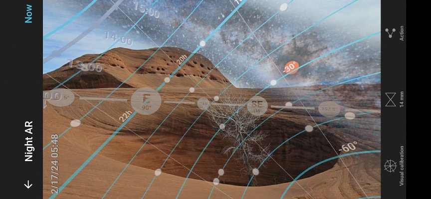
Above is the plan that I had in place. Below is the result.

Once the Blue Hour was near its end, the Milky Way was no longer visible. Even still, it wasn't light enough for me to get my bearings on how to get back to my vehicle. I'd have to wait until sunrise to begin the trek out. In the meantime, I hobbled around looking for a sunrise composition.

Between the above and below images, you can see how the land is anything but flat and how it might be difficult to find a single spot in the darkness. From the spot where I was sitting and watching the sunrise, I could turn around, reach out, and touch my tripod. I didn’t feel much like going far, so my sunrise composition wasn’t one that I wanted to explore around for. I chose a raised spine-like formation in the rocks. I knew there’d be light on one side and shadows on the other.

My main camera set-up: Nikon Z8 | 3 Legged Thing L-bracket | Benro carbon fiber Mach 3 tripod
Focus stacking allows you the ability to create an crisp image from front to back when in situations where having such an image isn’t possible in one frame. Would you like to learn how to Focus Stack? Hop on my calendar and let’s go shoot!
In the back of my mind, I am worried about this morning’s shoot. I was late to the shooting location. I was rushed getting the LLL set up. The clouds. The Blue Hour. The fading Milky Way. All of it was bothering me. You know what that means. Yep, I will not be crossing this off of my List-O-Place-To-Shoot. I’d have to return on a later date.
Finally, it was bright enough out for me to find my way out of the maze that I was in. This time, I’d try to remember how to get back should I ever return! Little did I know, returning would happen sooner than I thought!
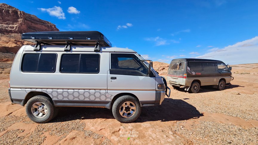
Along the way to my next destination, actually in the parking lot of my next destination, I bumped into another Delica in the wild!
I'm about to start a long hike into Reflection Canyon (R.C.). I've reduced weight everywhere possible. I want a sunset image and a sunrise image. May as well get them both while I'm here. Plus, mid-day light stinks, so I may as well hike during the day. I'll only be carrying essential camera gear, dinner/breakfast, and a bedroll. Sleeping under the stars tonight! Letting the air out of the bedroll wasn't fun. Not that it's difficult, I just don't want to blow it back up again! Lol If I can make it through this, the rest of the trip should be cake as this is the longest trek I’ve got planned.
I made it about 1/4 mile and knew I had to turn around. Both my knees must've known when I threw the backpack on and began a trek as they weren't happy about it. If they felt this way at 1/4 mile, how would they feel at mile 8? Tomorrow on the way back. Damn. I'd have to put this hike on my List-O-Places-To-Shoot for a return trip once my knees calm down. This typically takes a week or so.
Well, this definitely throws a wrench into my plans, but no worries. I planned on hitting Bryce National Park after Reflection Canyon. I still like the idea of getting to Bryce in the late morning, shooting during the day, and then again at sunset and sunrise, so I'm going to stick with that. That leaves me needing a new sunrise shooting location as I'm writing this evening's sunset off as a loss. I need the rest, so says my knees. I'll reshoot the tree in the hole and hopefully not get there late next time. My knees may complain, but the hike in is short, so I'll just grin and bear it. It only throws this evening's sunset and tomorrow's sunrise off schedule. Everything else that I’ve planned should not be impacted.
DAY 3
Everything felt familiar, yet everything was so different. Here I was, wandering around in the dark, again, and having a difficult time navigating. This place is tough! Everything is so different in the dark, especially when your vision is limited to about 40'.
I wandered around until it was evident that there'd be no Milky Way this morning as the clouds were simply too thick. With that, I turned my attention away from the composition that I set out for, a Milky Way with some LLL, and more toward a direct sunrise composition. With it being cloudy, I'd be best off shooting directly at the rising sun.
I photographed quite a few compositions mostly geared toward heavy leading lines, clouds, and the Image Stacking Tutorial that I am writing..

Once finished, I gathered my things and headed off to my next destination, Bryce National Park. I had two compositions in mind that I really wanted. In the back of my mind, I was a bit worried tho, as a conversation with an individual earlier led me to believe that there was a lot of snow over that way. The snow is great, but I didn't necessarily want it in my compositions.
Sure enough, there was about 2' of snow at Bryce. Regardless, I stepped out to see how things looked. It was meh. I decided to come back on another day and pressed on toward Page and Monument Valley, AZ, and the rest of my regularly planned escapade.

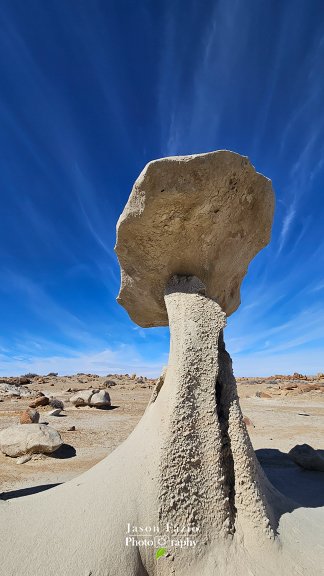
My next stop was an easy one. It was a fun little toadstool outside of Kanab. I'd wanted to shoot this in the past but never could make it happen for one reason or another.
As soon as I got to the toadstool hoodoos, I whipped out my cell phone and began working out compositions. Oftentimes, I will do this as opposed to getting all of my gear out. It didn't take me long to hone in on one. Unfortunately, by the time I got my camera out, the lighting was gone. Darn, I really wanted that shot. You know what that means! Yep, I decided to hang around until morning in the hopes of getting the image in my mind, or at least one similar. For now, it was back to the Five Billion Star Hotel (IG) for some much-needed food and rest!
DAY 4
The morning, like most on this trip, came fast! My alarm went off and I quickly began calculating whether or not I really had to get up or if I had time to spare. Nope; no time to spare. I had to get up. I whipped up some instant oatmeal and the last of Don's nasty instant coffee and was out the door.
I made it to the hoodoos with plenty of time to spare. I got up early and trekked into my shooting location in the dark. As daylight approached, my scene began to take shape. In this image, I felt that I needed a person in the scene to help show scale. I looked around. Nope, nobody. I'd have to jump in the scene myself.
Learn how to add yourself to the scene via my Time-Blending Training Session.

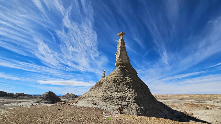
Hoodoos of New Mexico focus stacked and time blended
After shooting the image that I came for, I felt I had a bit of time available, so I wandered around the area to see what there was to see.

Remember those few moments that I spent wandering around the hoodoos? Well, I'd sure like to have them right about now. I missed the lighting that I was looking for by about 20 minutes. Bummer. Oh, well; I'll reshoot this one day under better lighting conditions.

A Tree’s Sanctuary, Time Blended Do you see me in the image?
I pulled off to the side of the road and did a bit of exploring. I found a neat little spot and set up a shot "The Tree" above. While trying to navigate the terrain, as well as my physical limitations, I managed to knock my camera and tripod down. That was bad enough. Watching the pair tumble down the muddy hill only added insult to injury.
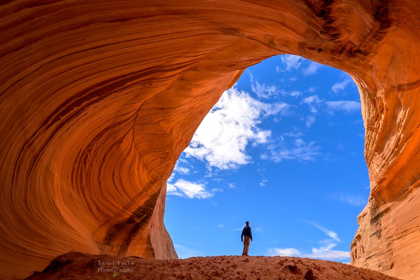
The Shell Cave of Page, AZ was a fun little shoot. It’s not really named that, I just made it up. It is quite a popular little spot. I was accompanied by six of my closest strangers while on this shoot. This is where I, as a photographer in a public location, simply have to know how to shoot the scene in a way that allows me to remove people from the image. Sure, sometimes people will gladly move out of your composition. Regardless, you must know how to deal with people in your compositions while shooting in public areas.

If you'd like to know how to get people out of your image in a manner that's better than clone-stamping or spot removal, and much more printer-friendly, I will have a section dedicated to it in my Intro To Landscape Photography online course. In addition, I teach it hands-on. You can sign up for one of my Time-Blending Sessions and I’ll teach you how to both shoot and process the image.
Learn to add yourself to an image with no rushing around trying to run into your own image before the camera’s shutter “clicks.”
Wind carved sandstone, Time Blended
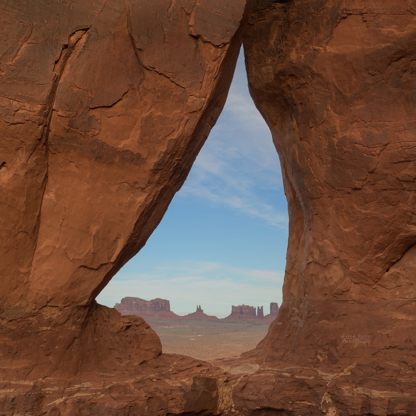
Leaving Page, I was headed toward Monument Valley. I had to obtain certain permissions in order to access an area that I'd spent the last few weeks searching for. I finally found it, but definitely didn't want to step on any toes by going without permission.
The hike up to the arch wasn't fun at all. Hiking in the sand during the previous evening really did my knees in. Those sore knees ended up negatively impacting the next day's plans (Reflection Canyon) and were again rearing their ugly head now. The hike was short, but much of it was in deep sand and all of it was uphill. The second half seemed so uphill that even Big Horn Sheep would struggle. Okay, that last bit was an exaggeration. However, needless to say, as you'll be able to tell from the images below, the hike was slightly uphill.
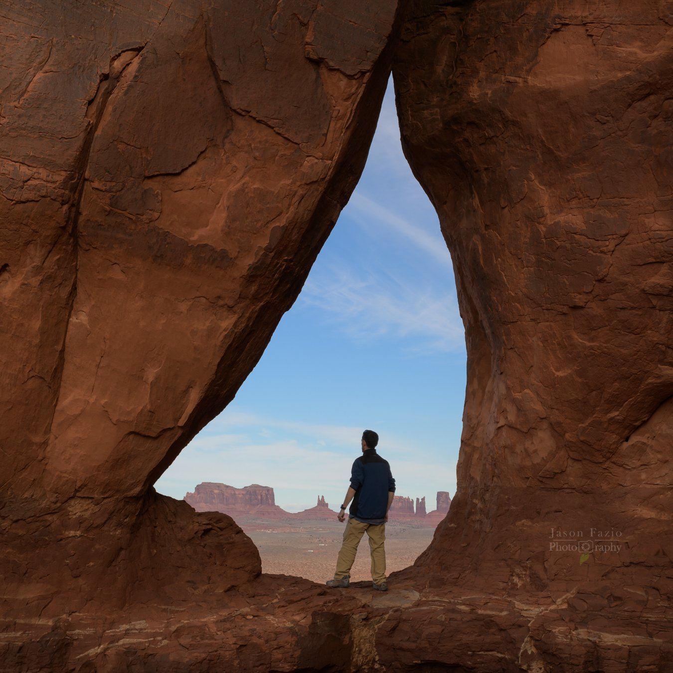
Once I got to the top, I enjoyed the view for a second and then began setting up. I reached for my tripod only to find that it wasn't there. I immediately remembered putting it under my rear seat in the Delica and not putting it in my camera bag as normal. Dang! I'd have to go all of the way back down to the Delica, get my tripod, and then slog all of the way back up here to the arch! There was no way I was doing that with my backpack and gear!
I set my stuff down, grabbed my water, and headed off back down the cliffside. I didn't have a lot of time to waste as the sun, as per usual, wasn't waiting around in me to get my crap together.
I made it down to where the Five Billion Star Hotel (IG) was parked rather quickly. Even the hike back up the cliffside wasn't too bad. It's amazing how that happens when you don't have to carry a loaded backpack.
I arrived up top in plenty of time to get my tripod all squared away. I had to raise it up a few inches using stacked rocks to get the composition the way that I wanted it. Then, the winds hit.

Had I not been paying attention, I'm 100% sure that my tripod would have blown over! The winds really began picking up as the sun sank lower in the sky. I ended up getting my paracord out for the 2nd time on this trip. This time, I used it to hang my gear from my tripod's center column. This supplied downward force on the tripod helping keep it upright as the winds continued to gust.

I’d been wanting this image for quite some time now. Although I was not elated at the day’s weather conditions, I was glad to have laid eyes on the area, and, in the end, I am happy with the outcome. Even still, this location is not off of my List-O-Places-To-Shoot. ;-)
Don’t throw away tools such as the Rule Of Thirds or the Golden Ration, but instead take a more practical approach that will fit any composition.
At this point in the road trip, I've skipped out on both Reflection Canyon and Bryce National Park. This had me a day ahead of schedule as I worked my way home. Tomorrow morning would be at a familiar location, but I'm only stopping out of convenience. I actually wanted to wander around the desert during the day. Tomorrow’s sunrise shoot would be a mere bonus.
DAY 5

The morning's sun found me beneath Shiprock in New Mexico. I was fine with reshooting Shiprock. It is always a beautiful sight to see. Shooting sunrise and then packing up had me getting to my next location around the 0900 hour which was perfect as I had a lot of scouting to do.

I spent the day wandering around the desert getting familiar with the layout. The skies were gorgeous which lent itself well to my desire to explore. Tho, I almost bit off more than I could chew with my selected route. If you ever decide you want to walk from the Alien Hatchery to the Rock Garden to the Three Wings and then back to the South Parking Lot with a full pack, don't!
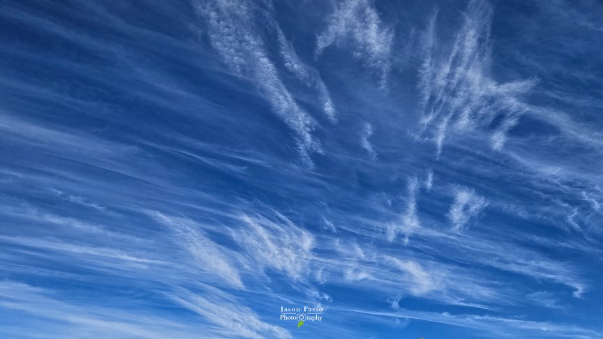
Tho, as previously mentioned, the skies were amazing! I was jaw-dropped as I walked around. Anything and everything was turned into a wonderful composition simply because the skies were so pleasing in every direction. Looking at the images below, there were only a few minutes between these two images being taken and look at the difference in the clouds! Option A is not a long exposure. It was taken at 1/100 of a second!


The next day, I planned on hiking into the Hatchery in the dark; hence why I wanted to explore a bit the day prior during daylight. The hike in would be totally in the dark and it would take an hour to get to the location assuming I didn't get turned around any.

DAY 6
As I headed in toward the Alien Hatchery the next morning, it was darker than dark, and in the dark, there were no landmarks until directly upon a rock formation. It was the same way when I photographed the tree in the hole. Add to that, my map position indicator was spinning and my other app had me facing the opposite direction. This took a while to figure this out and once I realized my instrumentation was off, the skies were beginning to show signs of the impending sunrise. Tho, with that, there was finally, there was enough light to land navigate.

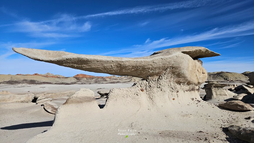
Bisti took everything that I had. On my first day there, I returned to the Five Billion Star Hotel (IG) around lunchtime, ate lunch, and crashed. I didn’t wake up until it was time to head out into the morning’s darkness. After shooting The Hatchery and hiking back to the Delica, I was done. Exhausted, I cranked up and headed for Monument, Colorado.
